GAP trail connects to the 185 mile long Chesapeake & Ohio (C&O) Canal Towpath which runs along the Potomac River from Cumberland, MD, to Washington, DC. Together, the GAP and C&O Canal add up to over 300 miles of trails.
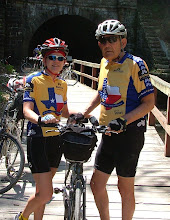
 We were invited to join nine of the ROMEO’s (Retired Old Men Enjoying the Outdoors) to cycle the GAP and C&O Canal the end of April 2010. This was a ride for hybrids and mountain bikes; definitely not skinny tire road bikes. The trail surface was a mix of hard packed dirt, crushed limestone, rocks, gravel, and a few miles of paved path. At times, we found ourselves dodging potholes, tree limbs, and low hanging branches. We even had to maneuver over and around a few downed trees. Including the miles we cycled to and from our lodging each day, we rode a total of 342 miles over 5 days.
We awoke our first day to freezing temperatures so we held off our start until about 9:00am. Bundled up, we gathered ourselves in the van and headed to the McKeesport trailhead, 14 miles out of downtown Pittsburgh. The path was fairly smooth with a slight incline which followed alongside the Youghiogheny (Yock-uh-gay-nee) River. We stopped about every 15-20 miles with our first stop in West Newton, PA.
 As we cycled on, the temperature warmed and we found ourselves switching from our heavier jackets to light wind jackets. By the time we reached Ohiopyle, about 60 miles, the winds picked up and it got down right cold again. From here, we passed bridges, waterfalls, and timber footpaths on the way to Confluence and the Stepping Stone Farm B&B where we stayed the night.
Again, we awoke to freezing temperatures the next morning. Wearing our winter gear, we rode from the B&B to the trail and continued along the GAP trail. Other than freezing at the start, this was a fairly uneventful morning. We stopped in Meyersdale, PA, for lunch. Cycling the last 8 miles uphill to the high point in the trail brings us to the Eastern Continental Divide, which separates the Chesapeake Bay and Gulf of Mexico watersheds. Ahhhh! Now it’s downhill the rest of the trip. The average grade of the trail never exceeds about 1% except for this next section down to Cumberland which is about 2%. As we started downhill, we passed through the Big Savage Tunnel, crossed the Mason-Dixon line from Pennsylvania into Maryland, then it was 20 miles straight in to Cumberland, MD, where we stopped for the night and the GAP trail ends.
Our third day starts directly outside our hotel on the C&O Canal Towpath.
 Temperatures were cool but warmed up quickly. The trail follows the Potomac River all the way to Washington, DC. The C&O trail was rougher than the GAP trail. In fact, full-suspension mountain bikes might have been better than our hybrid bikes. We started dodging potholes, tree roots, and large rocks on this section as we passed numerous aqueducts and locks. At times, the towpath surface devolved into a two-track with a grass strip lining its middle. Twenty eight miles later, we reached the famous Paw-Paw Tunnel, a 3,118 ft long canal tunnel which was built to bypass the paw-paw bends, a six mile stretch of the Potomac River. Construction on the tunnel began in 1836 and completed in 1850. Once in the tunnel, we could barely see the light at the other end so be sure to take a good headlight. With the canal wall on one side and a wooden rail on the other (with a big drop off to the canal), it was a little scary riding the bumpy trail in the dark. After clearing the tunnel, we stopped for lots of photos. Then, we cycled on to Bill’s Tavern in Little Orleans for lunch, then headed to our hotel in Hancock, MD, at the foot of the Appalachian Mountains.
 Paul had a cut tire from the rocks on the trail so we started the next day at the C&O Bicycle Shop getting a new tire. We then headed out on a very smooth, paved path for the next 12 miles to Fort Frederick State Park where we regrouped and toured the fort and grounds. Fort Frederick was erected in 1756 during the French and Indian War. Back on the towpath we began dodging rocks, potholes and tree roots again, in fact, we wondered why anyone would take a nice packed dirt road and dump truck loads of rocks on it. But,
 we continued on. We passed more aqueducts and locks, saw families of geese, turtles, rabbits, and a variety of birds. The geese were very protective of their babies and hissed at us as we cycled by. This was our hottest day….temperatures reached a record setting 93 degrees. We finally made it to Harpers Ferry, WV, where Maryland, West Virginia, and Virginia all come together. There was no place for the van to pick us up so we had to carry our bikes up a spiral staircase to cross the pedestrian/railroad bridge in to town and then it was uphill to the hotel.
Our last day of cycling took us from Harpers Ferry all the way to Alexandria, VA. Our first stop today was at White’s Ferry. The General Jubal A. Early Ferry transports eight cars at a time across the Potomac and is the only remaining ferry on the river. The next 20 mile section to Great Falls, VA, was the roughest and slowest section of the trail. Rocks, rocks, and more rocks on the trail. Great Falls had magnificent views of the Falls of the Potomac, Mather Gorge, and Patowmack Canal locks. After a BBQ sandwich lunch and viewing the falls, we continued to Georgetown, the end of the C&O Towpath. We climbed some more stairs carrying our bikes, crossed the Key bridge, and cycled the paved bicycle path about 8 miles to Alexandria where our van picked us up and took us to our hotel. This section of bike path was very picturesque with views of the Capitol, Washington Monument, and Lincoln Memorial in the distance. We had a nice dinner at Gadsby’s Tavern in town and I think we all slept like babies that night.
We awoke to light rain the next morning so we cancelled our ride we had planned to Mount Vernon and, instead, took the metro to the mall area of D.C. where we visited
 a couple of the Smithsonian Museums and walked to all the monuments; Washington Monument, World War II Memorial, Vietnam Veterans Memorial, Lincoln Memorial, Korean War Memorial, and the Franklin Delano Roosevelt Memorial. Well, we didn’t cycle any miles on the bike this day but we covered miles and miles on our feet.
This was a great trip. We had a couple of extremely cold mornings, warm to hot afternoons, and no rain until the last day. Overall, we couldn't have asked for better weather for this trip. We cycled between 62 and 75 miles each day which took us anywhere from 5 ½ - 6 ½ hours pedaling time. Including our rest breaks and numerous stops to take photos, we had a full day of cycling every day. We burned a lot of calories and ate a lot of really good food.